


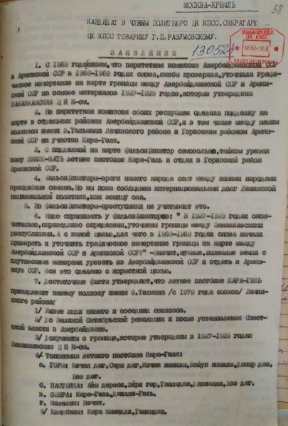
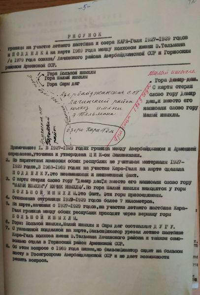
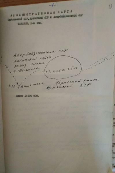
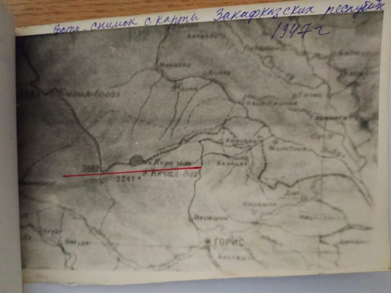
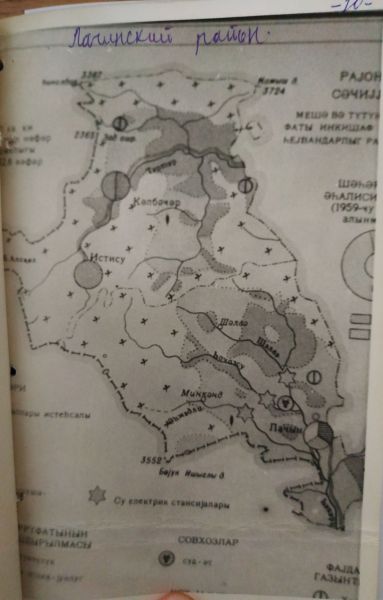
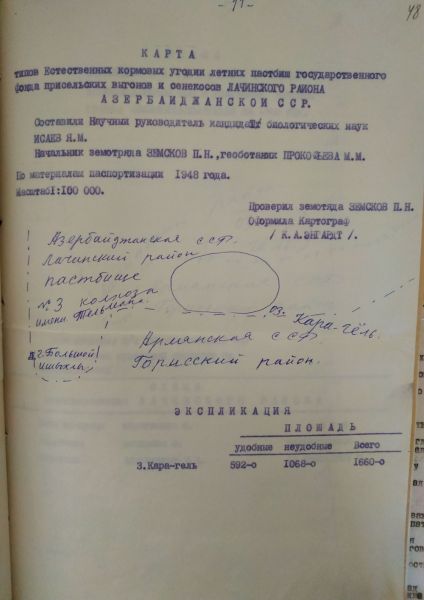
Recently, the process of delimitation and demarcation of the borders between Azerbaijan and Armenia has begun. One of the most fragile parts of the border between the two countries passes through Garagol in Lachin district. Back in 1921, during the border discussions, there was no dispute that Garagol was the territory of Azerbaijan. During the final demarcation of the borders between the Transcaucasian Soviet Republics in 1927-1929, Lake Garagol fell entirely into the territory of Azerbaijan and was reflected in the maps prepared at that time. In those years, the results of the demarcation of the borders between the two republics were approved by the Transcaucasia Central Executive Committee. In the documents approved by the Transcaucasia Central Executive Committee, the name of this area is called with the toponym Garagol, and the surrounding geographical points: Mountains - Kechal Dagh, Yellow Dagh, Boyuk Ishigli, Kichik Ishigli, Damir Dash, Boz Dagh; Pastures around the lake: Ayi Darasi, Ayrigar, Ganlija, Delijali, Boz Dagh; Place of worship: Mosque; Cemeteries: Gara Mammadli, registered as Ganlija. All these demarcations were confirmed in the maps prepared by the Department of Geodesy and Cartography under the People's Commissars of the USSR and published in Moscow and Tbilisi printing houses at that time. There are many interesting documents, letters, appeals, and references about Garagol in the Russian State Archive of Contemporary History.
However, starting from the 30s of the last century, attempts were made by the Armenian SSR to seize the Garagol settlement. In 1930-1932, the pastures of more than 300 hectares, which were always used by the Azerbaijani livestock, were disputed by the Armenians, and in 1934, half of these areas were taken from the Azerbaijanis.
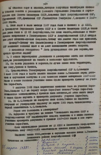
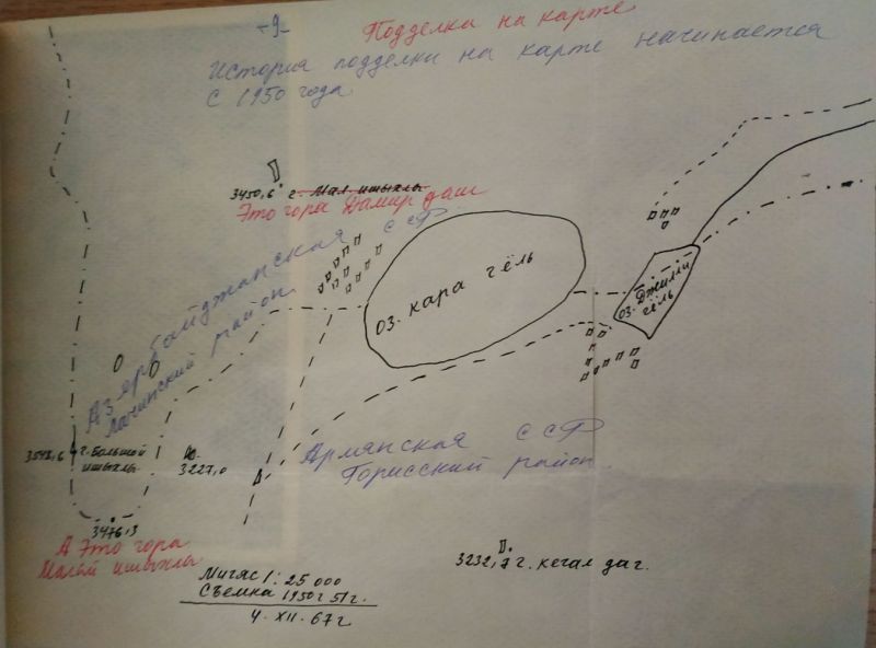
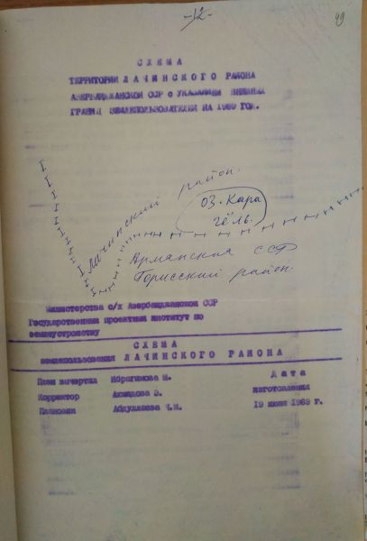
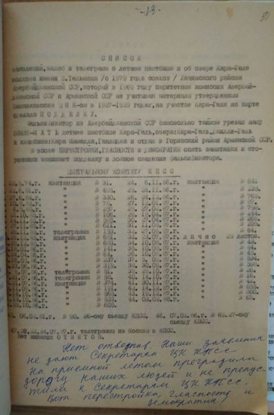
Beginning from the 1950s, it took on an open character. In 1951, the USSR Council of Ministers banned Azerbaijani livestock from using the ancestral pastures around Garagol. In 1967, with the direct intervention of the central authorities of the USSR, this process was fully completed. Although the second secretary of the Central Committee of the Communist Party of Azerbaijan, Pyotr Yelistratov, appealed to the Central Committee of the Communist Party of the Soviet Union in June 1967 and May 1968, the issue could not be resolved. Instead, on June 10 and 20, 1968, the Council of Ministers of the Soviet Union and on June 23, the Central Committee of the Communist Party of the Soviet Union instructed both republics to settle territorial disputes between the individual collective farms of the Azerbaijani SSR and the Armenian SSR. Finally, in 1968-1969, by taking advantage of the cowardice and obedience of the Soviet Azerbaijani leadership, the Armenian side, with the support of Moscow, managed to have the borders, which were demarked and approved in 1927-1929 and established Garagol as Azerbaijani territory, disputed and reconsidered.
So, in 1968-1969, when they reconsidered this issue, they committed a terrible fraud. The final decision of the Transcaucasia Central Executive Committee to demark the boundaries was falsified, and some of the above-mentioned place names and toponyms were removed from the maps. For example, by deleting the Damir Dash from the map of the 1930s, the Armenians moved the border 7 km in the direction of Garagol. They were able to "slide" to the Azerbaijani side. And this led to the loss of control of the Garagol plateau, which was used by the collective farm named after Telman in Lachin district, and its transfer the use of Gorus district of Armenia. After that, although Garagol was declared a joint state reserve of the two republics in 1969, after a new inspection, the borders were kept open and Garagol was, in fact, handed over to Armenia. However, the residents of Garagishlag and other nearby villages, which unite the collective farm named after Telman in Lachin district (the state farm named after Telman since 1976), did not reconcile with this fraud. In May 1969, the Supreme Soviets of both republics approved these changes as a result of the falsification of documents.
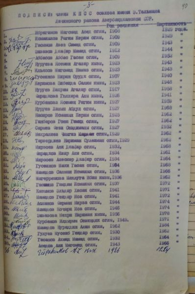
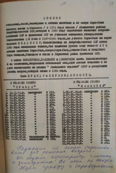
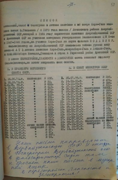
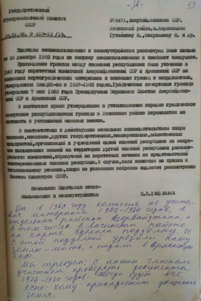
Since 1972, the residents of Garagishlag had begun to write numerous petitions and file numerous complaints to various bodies of the Soviet Union such as the Central Committee of the Communist Party of the USSR, the Presidium of the Supreme Soviet of the USSR, the Council of Ministers of the USSR, and the Pravda and Izvestia newspapers, reclaimed the lands confiscated from them illegally, by falsifying documents. Although parity commissions were established in 1987-1988 with the participation of the authorities of both republics in connection with numerous appeals of members of the state farm named after Telman in Lachin district and the population of Garagishlag village, the issue was not resolved. Instead of resolving the problem, they preferred to keep the territory of Garagol, which was artificially "disputed" by Moscow on November 17, 1987, as an inter-republican state reserve by the decisions of the Councils of Ministers of both republics. In fact, they created the conditions for the illegal control of Garagol and its environs by Gorus district, that is, they decided to continue the situation of 1969. At present, there are favorable conditions for resolving the issue in accordance with radical, historical documents, eliminating the falsifications and negligence around Garagol, and restoring the illegal changes in the maps published in Moscow and Tbilisi in the 1930s.


Want to say
-
Aliyev dwelled on the expanding North-South trade route – in which Azerbaijan serves as a hub for commerce connecting India, Iran and Russia – saying it had “global significance for cargo transportation and security.”
-
In honor of the holy month of Ramadan, I appeal to you with a plea for help and justice. Nine years have passed since the actions of our enemies plunged our family into darkness, depriving us of happiness and peace. Today they are trying to deprive our brother and me of our last home. This egregious act not only violates the laws of our country, but also ignores the fundamental right to housing, a principle that is supported throughout the world. It is important to note that the property in question was acquired in the 1990s, long before my brother Jahangir Hajiyev took up his position at the International Bank of Azerbaijan.
-
I would like to address society, but at the same time, the Georgian Dream and its representatives.
-
In a dramatic turn of events on March 26, corrupt and once-powerful former customs official Rayimbek Matraimov was loaded onto a plane in Azerbaijan and flown to Kyrgyzstan to be arrested. Images circulated in local media showed Matraimov being hauled off a plane in handcuffs by masked agents with the State Committee for National Security, or GKNB.


Leave a review